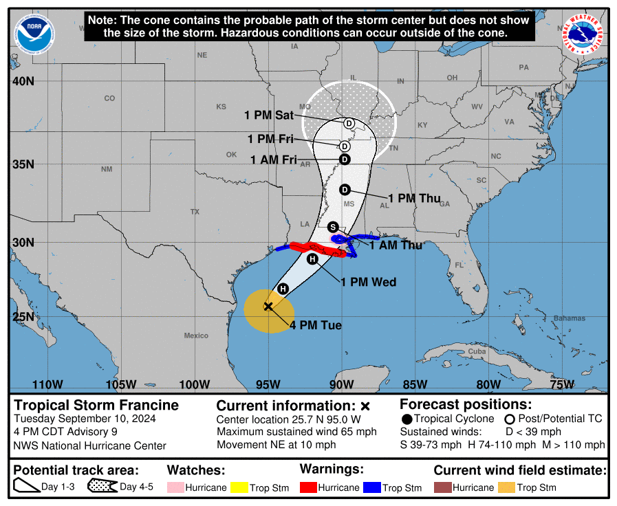
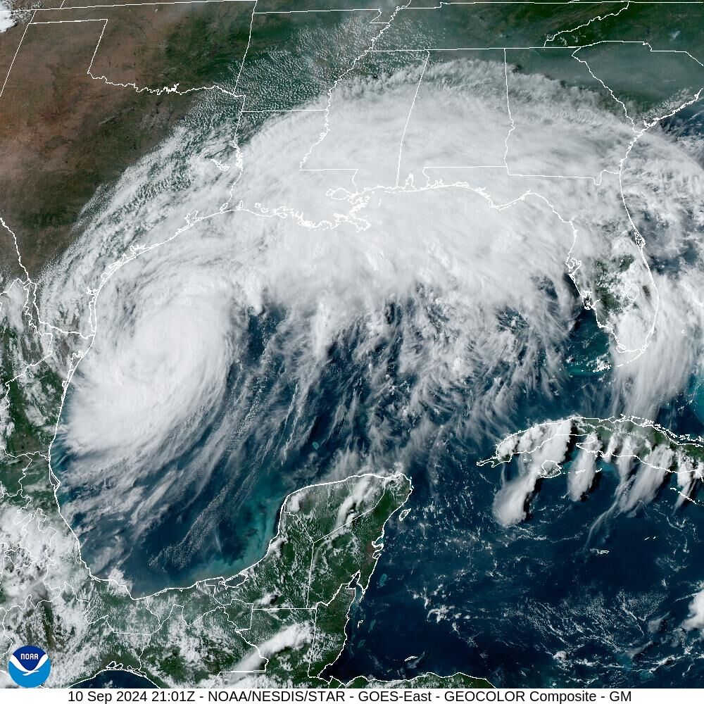
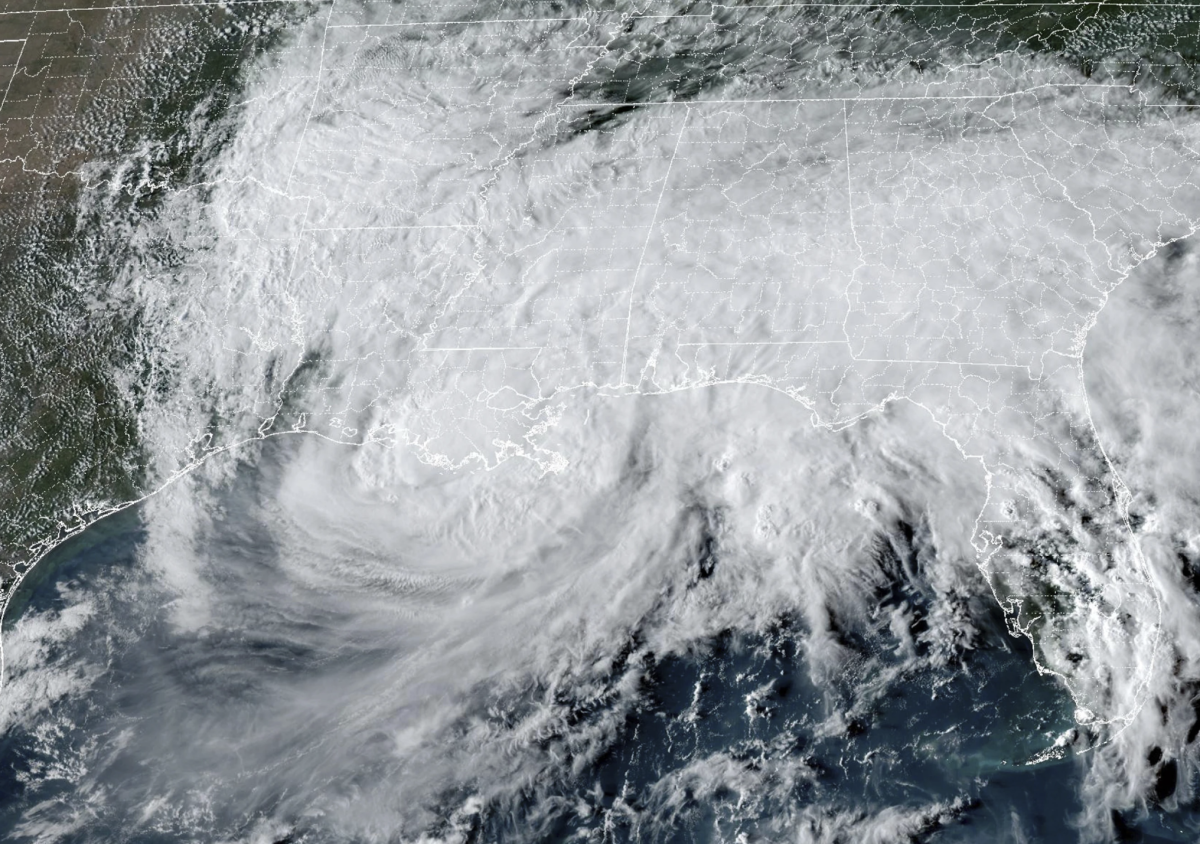
Tropical Storm Francine’s status has been upgraded to a hurricane. Its trajectory toward the Louisiana coast, where the National Hurricane Center forecasts the storm will make landfall with Category 2 strength, has shifted further east.
The latest reports from the NHC show “cone of uncertainty,” or the projected path the hurricane will take, as having moved closer to New Orleans, likely near Morgan City. A hurricane watch is now over New Orleans.
Baton Rouge is still squarely in the storm’s path, forecast maps show.
According to the report, Francine has about a day to strengthen before hitting Louisiana’s coast.
Mississippi Gov. Tate Reeves declared a state of emergency Tuesday afternoon ahead of Francine’s landing. He joins Gov. Jeff Landry who declared a state of emergency in Louisiana Monday evening.
Most city-parish services, courts, schools and parks in Baton Rouge will be closed until Friday, according to the city’s emergency information page. Many southern parishes have called for particular residents to evacuate.
LSU officially closed campus on Tuesday at 4:30 p.m. and moved to remote learning through Wednesday and Thursday. It urges students and residents to be proactive. A shelter in place order will last from 10 a.m. Wednesday to 1 p.m. Thursday.
The NHS said flash and urban flooding is likely in Gulf-south regions. Expect “life threatening” storm surge on the Louisiana and Mississippi coast and hurricane force winds in regions under a hurricane watch. Areas inland are at risk of tornados. Wind speeds may reach 100 miles per hour.
This story was updated to reflect Francine’s status as a hurricane from a tropical storm.


