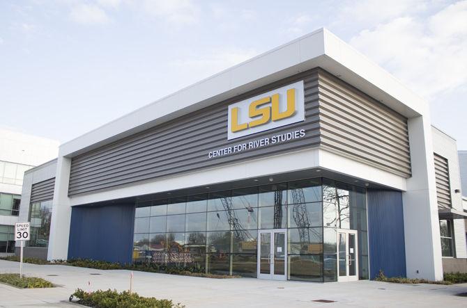
The Mississippi River is both a blessing and a curse. It drives commerce for Louisiana, but the act of diverting the river resulted in huge loss of the state’s wetlands. With the new LSU Center for River Studies, the University aims to help solve this problem.
Gov. John Bel Edwards joined officials from the City of Baton Rouge, the University and the Coastal Protection and Restoration Authority, and the Baton Rouge Area Foundation to unveil the new Center for River Studies in an area of Baton Rouge called the Water Campus on Jan. 29.
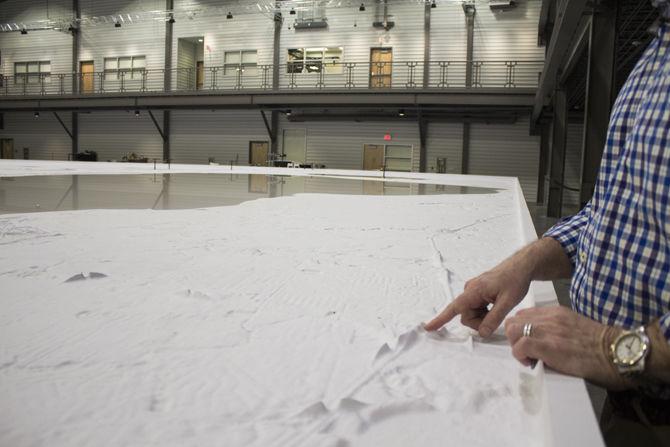
The centerpiece of the Center for River Studies is the Lower Mississippi River Model, a scale model of the Mississippi River. The facility will also feature educational exhibits.
“The idea of a physical model is to scale down the real-world system in a way that allows us to do controlled experiments in a certain-sized laboratory or space,” said director of the LSU Center for River Studies and the Mike Dooley Professor of Civil and Environmental Engineering Clint Willson in a press release. “And at the same time, you want to replicate the physics of the system as you can.”
The University originally planned to house the model on campus, however they were given the opportunity to build it on the Water Campus. The model is made up of 216 five-by-ten foot high-density foam panels.
“It took us over a year just to route the panels,” Willson said. “Those were routed on the LSU campus while the building was being constructed. Once the building was finished, the panels were transported to the Center. Then a contractor probably spent about five months, maybe a little longer, actually constructing the model inside the Center.”
Willson said the process for designing the model was iterative, as there was limited space to create a model of a massive river. The CPRA also provided funding for all aspects of the project.
Willson said that a foot on the model represents approximately a mile of the real Mississippi River, and that an hour of water flow in the model represents about a year of flow in the Mississippi River.
“We basically take all the topography of the land around the river in the area that we’re modelling, and you scale that down by basically one mile to one foot,” Willson said. “We do some other scaling with elevation, then, finally, we choose a sediment, we choose particles that we’re going to use in our physical model that will replicate or represent the way the sand moves in the Mississippi River.”
The Center will be used to conduct experiments, but Willson said it will also be used to educate people about the Mississippi River, as well as provide a collaborative space for scientists, engineers and government officials.
“The education component is critical and key, and really an amazing access,” Willson said. “We have this amazing opportunity to communicate with the public, to communicate with policy-makers, to communicate to stakeholders, to middle school and high school students, and the general public why we have this. Teach them about the river. Educate them about why we leveed the river and why the federal government needed to do that for navigation and to protect people from flooding, and then talk about the consequences of that leveeing.”
Willson said he also hopes to use the Center as a place to host collaborative discussions where scientists can discuss their research. He particularly hoped that it could be a place for lawmakers and government officials to come to learn about the coast and meet with leading coastal scientists in order to make more informed policy decisions.
Creating the Center for River Studies took a long time, but Willson said it was worth the wait.
“I think the vision from five or more years ago, that vision of what we could do in terms of not just the research, but the education and the outreach really, I think, kept everyone motivated and kept them more on track,” Willson said. “It made it worth the wait.”


