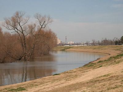
The National Weather Service extended a flood warning affecting Baton Rouge until Thursday for the Mississippi River at Red River Landing.The river was at 34.3 feet in Baton Rouge at 7 a.m. Monday, according to the NWS. Flood stage is 35 feet, and the levee top is 49 feet, said Phil Grigsby, NWS forecaster. The river was above flood-stage for most of last week, according to NWS.The flooding has been minor and has only affected river islands and should not cause major damage to residential areas, Grigsby said.Flooding typically puts stress on the levees, and city engineers are taking steps to mitigate problems that might be associated with floods, said Jim Ferguson, city-parish drainage engineer.”The river has gone above its normal height four or five times in the last few years,” Ferguson said.Areas affected by floods include River Road, where the ditches on the side of the road fill with water, and the Brightside and River Bend areas where water comes up through the asphalt, Ferguson said.City engineers monitor the levees three times a week when the river rises above flood-stage in an attempt to be proactive, he said.High river levels have been caused by excessive rains affecting the eastern United States, said Barry Keim, Louisiana state climatologist.Keim said the eastern United States feeds the Mississippi River, and the moisture levels in that region have been above normal this year.Rain that falls in Baton Rouge has very little effect on the water level of the river, Keim said.The level regularly rises around May when snow from northern parts of the river melts, but flooding near Baton Rouge is abnormal for February, he said. Long-term outlooks for river levels are made by the Lower Mississippi River Forecast Center, a division of NWS located in Slidell.The projections show levels remaining above average for the near future because they will only increase when the snow upstream begins to melt, Grigsby said.—-Contact Jacob Most at jmost@lsureveille.com
Flood warning issued affecting BR
February 23, 2010

The river at the River Road levees by the Vet School has risen to the flood stages, according to the NWS.


